
ZEITRAUM Planungen is tackling the challenge of carrying out a comprehensive local planning revision while simultaneously analyzing neighborhoods to secure existing structures and specifically guide future developments. With LUUCY, the team found a digital tool that seamlessly combines planning, visualization, and scenario comparisons.
From Analysis to Scenario: Try & Error Made Easy
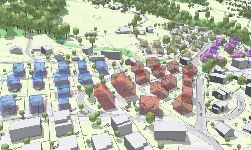
With LUUCY, ZEITRAUM Planungen can directly visualize and compare different variants for the zoning plan. The team contrasts the current building stock with existing zoning rules and quickly identifies where adjustments are necessary, such as for the site occupancy index or building height. Through a playful «try & error» approach, different strategies can be tested without losing the underlying basis for decision-making.
Parametric Perspective and Neighborhood Overview
The parametric adjustment of multiple parcels or entire neighborhoods simultaneously is particularly helpful. This allows ZEITRAUM Planungen to assess the impact of planning decisions at the neighborhood and municipal level in real-time. Scenarios are not only visualized but also quantified—a massive advantage for strategic planning.
Precision Through Authoritative Terrain
Another plus: LUUCY uploaded the modeled and authoritative terrain into the platform. Heights, terrain shapes, and topography are accurately represented, allowing the impact of planned construction projects on neighborhoods and the cityscape to be realistically assessed.
Result: Efficient, Well-Founded Planning
LUUCY helps ZEITRAUM Planungen carry out local planning revisions efficiently, prepare scenarios in a comprehensible way, and derive well-founded recommendations for adjustments to the zoning plan. The digital platform significantly facilitates decision-making and makes planning more transparent—both for the planning team and the authorities involved.
Conclusion:
LUUCY supports ZEITRAUM Planungen in neighborhood analyses for local planning revisions. Through the combination of scenario comparisons, parametric modeling, and precise terrain representation, decisions can be made faster, more soundly, and with greater traceability—a real win for spatial planning.